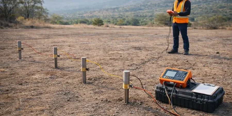
Any foundation design east of the Hayward Hills or west toward the shoreline has to contend with one thing: the Hayward Fault. IBC and ASCE 7 don't just suggest a geotechnical look at the subsurface here—they practically demand it. Conventional drilling tells you what's at one point, but electrical resistivity imaging, particularly Vertical Electrical Sounding, fills in the gaps between boreholes. We run VES arrays across lots where the topsoil is only 18 inches thick over Franciscan Complex bedrock and across the deep alluvial fans near Sulphur Creek. The ASTM D6431 standard guides the field setup, but the real value comes from interpreting how current flows through saturated versus dry layers—critical when mapping perched water that could destabilize an excavation. For deep infrastructure, combining VES with CPT testing gives us a continuous profile of the transition from stiff clay to weathered shale without guessing.
A VES sounding doesn't just find water—it shows you how the soil layers connect across 300 feet of property, something no single borehole can do.
Site-specific factors
Hayward sits right on a major fault, but the less obvious risk is the lateral variability in soil saturation. One property can be bone-dry gravel at 12 feet while the lot next door has perched water at 8 feet, thanks to a buried clay lens. Electrical resistivity catches that before the backhoe does. Ignoring these contrasts leads to over-excavation, unexpected dewatering, or worse—differential settlement under a slab-on-grade because half the footing bears on saturated silt and the other half on dry sand. The method also screens for old debris fills and abandoned stream channels that don't appear on historical maps. We've surveyed parcels near downtown where former creeks were filled in the 1920s, and the resistivity profile lit up the boundary between native soil and loose trash fill like a neon sign. For sites within the Alquist-Priolo zone, where trenching is mandatory, resistivity lines help position those trenches where they'll actually intercept the fault trace instead of missing it by 20 feet.
Questions and answers
How much does a VES resistivity survey cost for a typical Hayward residential lot?
For a standard residential lot in Hayward—around 5,000 to 7,000 square feet—a VES program with three to five sounding stations typically runs between US$580 and US$990 per station, depending on the depth penetration required and site access conditions. A full survey with interpretation and a stamped report is usually in that range.
Can resistivity surveys detect the Hayward Fault on my property?
Yes, but with nuance. Resistivity imaging can identify the contrast between fault gouge, fractured rock, and intact strata, which often shows up as a sharp lateral change in apparent resistivity. However, for official fault setback determinations under the Alquist-Priolo Act, resistivity data must be ground-truthed with exploratory trenches. We typically use ERT lines to guide trench placement so you excavate where the geophysics says the feature is, not where you guess it might be.
How deep can you see with electrical resistivity in the Hayward area?
The practical exploration depth depends on the array geometry and the local soil resistivity. In Hayward's saturated alluvial soils, a Schlumberger array with a 300-foot current electrode spread reliably images down to 80–100 feet. In drier upland areas with higher resistivity, the same spread might reach 120–150 feet. We design the array for each site based on the target depth you need—whether that is a shallow groundwater survey at 30 feet or a bedrock mapping job at 100 feet.